

In 1762, British forces occupying Manila seized a set of copper plates as war booty and shipped them to England. The plates were the original engravings for the Murillo Velarde map, the most consequential cartographic document the Philippines has ever produced, and their removal from Manila was an act of colonial plunder that nearly erased the primary record of 18th-century Philippine geography.
That the map survived is down to timing. Copies had already been printed and distributed before the British arrived. Those copies reached institutions, private hands, and colonial administrators across three continents. One eventually made its way to the National Library of the Philippines, donated by technology entrepreneur Mel Velarde. Others remain in private collections and archives worldwide, with only 14 to 15 known originals confirmed to exist.
For collectors of Philippine historical maps, the Murillo Velarde map Philippines specialists have documented for three centuries is the fixed point around which everything else is measured. This guide covers the charts that matter most, the documents that named the islands, defined their borders, and argued their sovereignty before an international tribunal in 2016.

The Murillo Velarde Map Philippines Cartographers Could Not Improve On
European cartography of the Philippines begins with a name. The Ramusio-Gastaldi map of 1554 was the first to use "Filipina," applied to a Visayan island, likely Leyte or Samar. The name appeared on a map produced in Venice by scholars working from Portuguese navigators' accounts. The island it labeled bore little resemblance to modern geography. The name, however, held.
Through the late 16th century, cartographers in Antwerp, Rome, and Amsterdam produced Philippine maps with increasing frequency and compounding inaccuracy. The De Jode map of 1593 and the Van Linschoten chart of 1596 each borrowed from what came before, errors copying forward across editions. The Philippines moved through European printing houses as an administrative abstraction, drawn by people who had never crossed the Pacific. Islands appeared in east-west orientation, Luzon placed left, Mindanao right. Coastlines were assembled from secondhand reports.
The Vesconte Maggiolo portolan of 1531 stands apart. A Mediterranean cartographic document relevant to ea rly Philippine exploration, it ranks among the most expensive individual maps ever sold globally and appears in major Philippine map exhibitions as evidence of where the archipelago sat in pre-colonial maritime geography. Its rarity puts it beyond most private collectors.
What changed in 1734 was method. Every map before it was assembled at a distance. The Murillo Velarde map was made in Manila, from direct observation, by people who lived within the geography they were recording. That shift produced a document so accurate that every significant Philippine map produced after it used it as a reference for the next century and a half.
What the 1734 Map Changed
Father Pedro Murillo Velarde was a Spanish Jesuit stationed in Manila when he directed the survey. Francisco Suarez, a Tagalog artist, drafted the central chart. Nicolas de la Cruz Bagay, a Tagalog engraver born in 1701, cut the eight copper plates. These were the plates the British seized in 1762. Before they left Manila, they had produced the copies that survived.
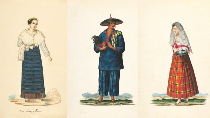
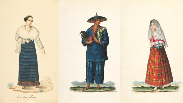
Bagay also engraved twelve border vignettes framing the central chart. The figures represent Philippine ethnic communities: Chinese merchants, Japanese traders, indigenous groups, mestizos, Mardica. Each is drawn with the specificity of direct knowledge. The vignettes are now regarded as a pioneering example of Philippine printmaking, a parallel document to the map itself, recording colonial-era society from within rather than imagining it from Europe.
The map named over 900 towns, cities, and villages. The 1734 Philippines map print became the cartographic foundation for Spanish colonial administration and maritime navigation. Subsequent mapmakers cited it directly.
When the Philippines brought its South China Sea case to the arbitration tribunal in 2016, the Murillo Velarde map was among 270 historical documents submitted as evidence. The map showed Scarborough Shoal, marked as Panacot, within Philippine territory. The tribunal ruled in the Philippines' favor. Former Supreme Court Justice Antonio Carpio had called the map a "living document." The 2016 ruling confirmed the description.
In December 2025, the National Library of the Philippines declared the 1734 Murillo Velarde a National Cultural Treasure. The designation is the country's most consequential heritage classification. A map engraved on copper plates in Manila, seized by British forces, dispersed across three continents, and cited before an international tribunal had taken 291 years to receive it.
Auctions, Collectors, and Where the Market Sits Now
The auction record for the Murillo Velarde map tracks across three decades and two hemispheres. A copy sold at Sotheby's London in 2014 for £170,500, approximately 12 million pesos. In 2019, a copy sold in Essex, England, breaking that auction house's records. In 2020, another copy sold at Leon Gallery in Manila for 40 million pesos, approximately 1.06 million US dollars.
Each sale set a new floor. The trajectory has not reversed.
Original copies now sit in institutions and serious private collections. The Philippine Map Collectors Society, PHIMCOS, founded in 2007 by five cartophiles in Manila, built the community that documented this market. Members loaned 165 original maps for a major exhibition at the Metropolitan Museum of Manila. A subsequent exhibition at the Ayala Museum, Insulae Indiae Orientalis, brought together more than 150 original maps from the 16th to 20th centuries. The 2025 Classics of Philippine Cartography exhibition at the National Museum of the Philippines showed 90 original PHIMCOS maps.
Gallery of Prints, the first Philippine gallery devoted exclusively to antique maps and prints, specialises in 16th-century cartography including maps carrying the earliest recorded uses of the name "Filipina." For collectors entering the market, the Gallery offers documented period works at accessible price points.
For most buyers, the 1734 Philippines map print in archival reproduction is the practical route into this history. The original document is held in institutions. The cartographic record Bagay cut into copper, 900 named settlements, twelve community portraits, coastlines verified by direct survey; transfers fully to an archival reproduction made with the same fidelity to detail that the original demands.

The Treaty of Paris Map: Cartography as Transaction
Not every collectible Philippine map is a colonial-era survey. The Treaty of Paris map of 1899 occupies a separate category entirely. A montage of six sea charts assembled into a document measuring 273 centimeters by 144 centimeters, it was physically attached to the treaty that formalised Spain's transfer of the Philippines to the United States for 20 million dollars. The map defined the archipelago's territorial limits under American administration. Where the Murillo Velarde described a geography, the Treaty of Paris map transferred one.
The two documents together frame the entire Spanish colonial period. The Murillo Velarde opens it with scientific precision in 1734. The Treaty of Paris map closes it commercially in 1899. Between those two dates, every administrative decision made about the Philippine archipelago referenced the geography Murillo Velarde, Suarez, and Bagay documented.
The 1930s Coast and Geodetic Survey maps, produced by the American administration as a 16-sheet topographic series of the Philippine islands, continue this tradition: cartography in the service of governance, produced with the precision of a body that needed to know exactly what it controlled. For collectors focused on Philippine political history rather than purely cartographic history, the Treaty of Paris map and the Survey series represent a distinct and underexplored collecting category.

Why the Document Matters in a Collection
The Murillo Velarde map Philippines collectors and institutions have pursued for three centuries is not a decorative object. Neither is the Ramusio-Gastaldi, the Treaty of Paris montage, or the Maggiolo portolan. These documents were used. Decisions about Philippine territory, sovereignty, and administration were made from them. Collecting them is an act of engagement with primary sources, not with representations of history.
For collectors building spaces around Philippine heritage, an archival reproduction of the Murillo Velarde carries something that most decorative prints cannot offer: a verifiable record, named makers, and a documented place in the events that shaped the modern Philippines. Bagay's twelve border vignettes reward sustained attention. Each figure he engraved represents a specific community that existed in 18th-century Manila, rendered by someone who shared that world and cut it into copper one line at a time.
The 1734 Philippines map print is available from Maynila Archive as a museum-quality archival reproduction, printed on premium fine art paper using giclée technology. The print is available here: Mapa de las Yslas Philipinas, 1734 by Pedro Murillo Velarde.
The plates Bagay cut in 1734 were taken to England twenty-eight years later. The copies had already been printed. That is why the coastlines he drew are still visible today.
Mapa de las Yslas Philipinas, 1734 by Pedro Murillo Velarde

Available as a Fine Art Print
The first scientific map of the Philippine archipelago, engraved on copper by Tagalog craftsman Nicolas de la Cruz Bagay, carefully restored and reproduced as a museum-quality fine art print on archival paper. Every named settlement and border vignette from the original 1734 document is preserved in full detail.
Made to order for collectors and heritage enthusiasts.
Visit our shop:
Mapa de las Yslas Philipinas - Maynila Archive


